Det ligger naa en gigantisk storm ute i Atlanteren, den dekker faktisk omtrent hele havomraadet fra USA til Europe. Du finner mer paa sidene til NRK og TV2 tipper jeg. Heldigvis gaar den sydenfor oss, og kommer innover Portugal og Spania og man haaper daa at den er blitt betydelig svakere. For oeyeblikket er den i samme styrke som en kategory 3 Hurricane, det bety vind paa godt over 70 knop, vel over 100km i timen. En slik storm er ikke noe hyggelig for de som er paa havet

Man faar haape paa det beste :-) Her et par klipp til
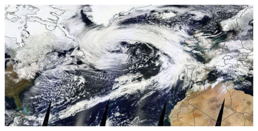
I'm not sure I've ever seen a storm this big before.
© NASA
The storm shown here stretches west to east from Newfoundland to Portugal. Its southern tail (cold front) extends into the Caribbean and the north side of its comma head touches southern Greenland.
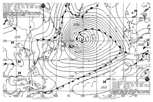
Not only is it big, but it's also super intense - comparable to many category 3 hurricanes. The storm's central pressure, as analyzed by the Ocean Prediction Center, is 953 mb. Estimated peak wave heights are around 25-30 feet.
© Ocean Prediction Center
The storm is forecast to remain more or less stationary over the next few days before substantially weakening and then eventually drifting into western Europe in about a week as a rather ordinary weather system.
Me bloggast :-)


No comments:
Post a Comment